
Thank you for supporting this site ❤️
Make a donation
Make a donation
Sherman County topographic map
Click on the map to display elevation.
Thank you for supporting this site ❤️
Make a donation
Make a donation
About this map
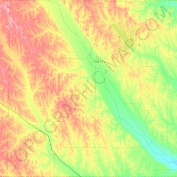
Name: Sherman County topographic map, elevation, terrain.
Location: Sherman County, Nebraska, United States (41.04625 -99.20781 41.39431 -98.74433)
Average elevation: 662 m
Minimum elevation: 589 m
Maximum elevation: 750 m
Thank you for supporting this site ❤️
Make a donation
Make a donation
Other topographic maps
Click on a map to view its topography, its elevation and its terrain.