
Lake Ashtabula topographic map
Interactive map
Click on the map to display elevation.
About this map
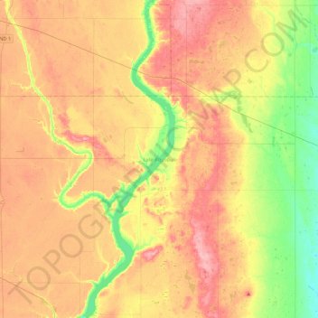
Name: Lake Ashtabula topographic map, elevation, terrain.
Location: Lake Ashtabula, Barnes County, North Dakota, United States (47.03330 -98.09965 47.33006 -97.95383)
Average elevation: 423 m
Minimum elevation: 370 m
Maximum elevation: 469 m