
Dickinson County topographic map
Interactive map
Click on the map to display elevation.
About this map
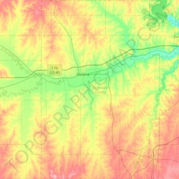
Name: Dickinson County topographic map, elevation, terrain.
Location: Dickinson County, Kansas, USA (38.60925 -97.37192 39.13354 -96.89004)
Average elevation: 387 m
Minimum elevation: 322 m
Maximum elevation: 482 m
Other topographic maps
Click on a map to view its topography, its elevation and its terrain.
Lake Jeanette
USA > Kansas > Leavenworth
Lake Jeanette, Lakeside Drive, Leavenworth, Leavenworth County, Kansas, 66043, USA
Average elevation: 253 m
Independence
USA > Kansas > Independence
Independence, Montgomery County, Kansas, 67301, USA
Average elevation: 245 m