
Thank you for supporting this site ❤️
Make a donation
Make a donation
Sälen topographic map
Click on the map to display elevation.
Thank you for supporting this site ❤️
Make a donation
Make a donation
About this map
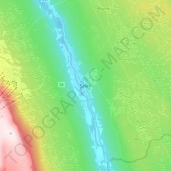
Name: Sälen topographic map, elevation, terrain.
Location: Sälen, Malung-Sälens kommun, Dalarna County, Sweden (61.11572 13.22941 61.19572 13.30941)
Average elevation: 514 m
Minimum elevation: 341 m
Maximum elevation: 894 m
Thank you for supporting this site ❤️
Make a donation
Make a donation
Other topographic maps
Click on a map to view its topography, its elevation and its terrain.