
Thank you for supporting this site ❤️
Make a donation
Make a donation
Gemeinde Silz topographic map
Click on the map to display elevation.
Thank you for supporting this site ❤️
Make a donation
Make a donation
About this map
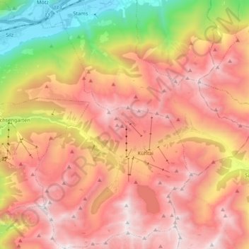
Name: Gemeinde Silz topographic map, elevation, terrain.
Location: Gemeinde Silz, Bezirk Imst, Tyrol, Austria (47.17042 10.89743 47.28239 11.05366)
Average elevation: 1,994 m
Minimum elevation: 633 m
Maximum elevation: 2,978 m
Thank you for supporting this site ❤️
Make a donation
Make a donation
Other topographic maps
Click on a map to view its topography, its elevation and its terrain.