
Florence topographic map
Interactive map
Click on the map to display elevation.
About this map
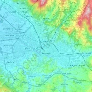
Name: Florence topographic map, elevation, terrain.
Location: Florence, Tuscany, Italy (43.72587 11.14976 43.83546 11.33890)
Average elevation: 142 m
Minimum elevation: 31 m
Maximum elevation: 696 m
Other topographic maps
Click on a map to view its topography, its elevation and its terrain.