
Thank you for supporting this site ❤️
Make a donation
Make a donation
Mount Kitanglad topographic map
Click on the map to display elevation.
Thank you for supporting this site ❤️
Make a donation
Make a donation
Mount Kitanglad
Due to its high elevation, several communications and broadcasting companies constructed relay stations at the summit.
Thank you for supporting this site ❤️
Make a donation
Make a donation
About this map
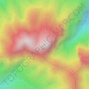
Name: Mount Kitanglad topographic map, elevation, terrain.
Average elevation: 2,393 m
Minimum elevation: 1,789 m
Maximum elevation: 2,850 m
Thank you for supporting this site ❤️
Make a donation
Make a donation
Other topographic maps
Click on a map to view its topography, its elevation and its terrain.