
Thank you for supporting this site ❤️
Make a donation
Make a donation
Carmen topographic map
Click on the map to display elevation.
Thank you for supporting this site ❤️
Make a donation
Make a donation
Carmen
Carmen has an area of 1.47 km² and an elevation of 1156 metres.
Thank you for supporting this site ❤️
Make a donation
Make a donation
About this map
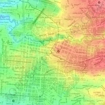
Name: Carmen topographic map, elevation, terrain.
Location: Carmen, Cantón San José, San Jose Province, 10101, Costa Rica (9.93175 -84.07905 9.94100 -84.06085)
Average elevation: 1,168 m
Minimum elevation: 1,118 m
Maximum elevation: 1,206 m
Thank you for supporting this site ❤️
Make a donation
Make a donation