
Pohangina River topographic map
Interactive map
Click on the map to display elevation.
About this map
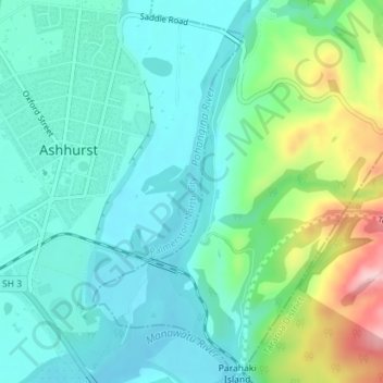
Name: Pohangina River topographic map, elevation, terrain.
Average elevation: 104 m
Minimum elevation: 49 m
Maximum elevation: 271 m
Other topographic maps
Click on a map to view its topography, its elevation and its terrain.
Palmerston North
New Zealand > Palmerston North
Palmerston North, Palmerston North City, Manawatu-Wanganui, 4440, New Zealand
Average elevation: 118 m
Kaimanawa Park
New Zealand > Palmerston North
Kaimanawa Park, Kelvin Grove, Palmerston North, Palmerston North City, Manawatu-Wanganui, New Zealand
Average elevation: 50 m