
Ruakākā topographic map
Interactive map
Click on the map to display elevation.
About this map
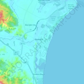
Name: Ruakākā topographic map, elevation, terrain.
Location: Ruakākā, Whangārei District, Northland, 0116, New Zealand (-35.91544 174.41571 -35.83544 174.49571)
Average elevation: 16 m
Minimum elevation: -18 m
Maximum elevation: 182 m
Whangarei District trails, hiking, mountain biking, running and outdoor activities
Other topographic maps
Click on a map to view its topography, its elevation and its terrain.