
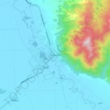
Te Aroha topographic map
Interactive map
Click on the map to display elevation.
Te Aroha topographic map, elevation, terrain
About this map
Name: Te Aroha topographic map, elevation, terrain.
Average elevation: 156 m
Minimum elevation: 7 m
Maximum elevation: 934 m
Routes: Matamata Piako District GPS tracks, routes, trails, hikes
Other topographic maps
Click on a map to view its topography, its elevation and its terrain.