
Thank you for supporting this site ❤️
Make a donation
Make a donation
Phi Phi Islands topographic map
Click on the map to display elevation.
Thank you for supporting this site ❤️
Make a donation
Make a donation
About this map
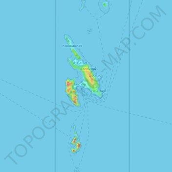
Name: Phi Phi Islands topographic map, elevation, terrain.
Location: Phi Phi Islands, Ao Nang, Krabi Province, 81210, Thailand (7.65404 98.75551 7.82061 98.79819)
Average elevation: 2 m
Minimum elevation: -3 m
Maximum elevation: 295 m
Thank you for supporting this site ❤️
Make a donation
Make a donation