
Thank you for supporting this site ❤️
Make a donation
Make a donation
Douglas County topographic map
Click on the map to display elevation.
Thank you for supporting this site ❤️
Make a donation
Make a donation
About this map
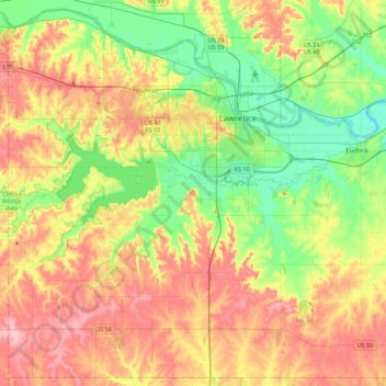
Name: Douglas County topographic map, elevation, terrain.
Location: Douglas County, Kansas, United States (38.73848 -95.50150 39.06978 -95.05589)
Average elevation: 294 m
Minimum elevation: 237 m
Maximum elevation: 365 m
Thank you for supporting this site ❤️
Make a donation
Make a donation
Other topographic maps
Click on a map to view its topography, its elevation and its terrain.