
Make a donation
Georges Township topographic map
Click on the map to display elevation.
Make a donation
Georges Township
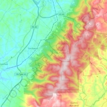
Georges Township is in southwestern Fayette County. It surrounds the boroughs of Fairchance (near the center of the township) and Smithfield (in the southwest). Pennsylvania Route 43 (the Mon–Fayette Expressway), U.S. Route 119, and Pennsylvania Route 857 cross the township, running roughly parallel. All lead northeast to Uniontown, the county seat. US 119 leads southwest to Point Marion, Pennsylvania, and Morgantown, West Virginia, while the Mon–Fayette Expressway provides a quicker route to Morgantown via Interstate 68 in West Virginia. The eastern boundary of Georges Township runs close to the crest of Chestnut Ridge, reaching a peak elevation of 2,760 feet (840 m). The lowest elevation in the township is 930 feet (280 m) along Georges Creek where it exits the township south of Smithfield.
Make a donation
About this map
Name: Georges Township topographic map, elevation, terrain.
Average elevation: 506 m
Minimum elevation: 289 m
Maximum elevation: 846 m
Make a donation
Other topographic maps
Click on a map to view its topography, its elevation and its terrain.