
Pūrākaunui topographic map
Interactive map
Click on the map to display elevation.
About this map
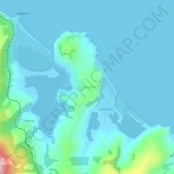
Name: Pūrākaunui topographic map, elevation, terrain.
Location: Pūrākaunui, Dunedin City, Otago, 9081, New Zealand (-45.77162 170.61840 -45.73162 170.65840)
Average elevation: 44 m
Minimum elevation: -4 m
Maximum elevation: 403 m
Dunedin City trails, hiking, mountain biking, running and outdoor activities
Other topographic maps
Click on a map to view its topography, its elevation and its terrain.