
Thank you for supporting this site ❤️
Make a donation
Make a donation
Kilsyth topographic map
Click on the map to display elevation.
Thank you for supporting this site ❤️
Make a donation
Make a donation
Kilsyth
Historically part of Stirlingshire, Kilsyth is at an elevation of 200 feet (60 metres) above sea level and occupies a narrow strip of land between the Kilsyth Hills to the north and the River Kelvin to the south. To the east and west it is bordered by marshland and bogs. The centre of the town is close to the confluence of the Garrell and Ebroch burns.
Thank you for supporting this site ❤️
Make a donation
Make a donation
About this map
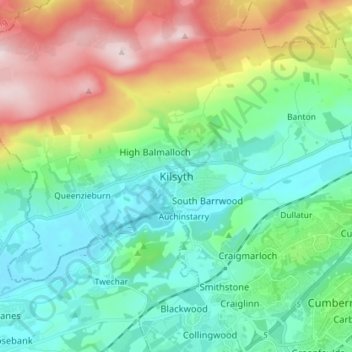
Name: Kilsyth topographic map, elevation, terrain.
Location: Kilsyth, North Lanarkshire, Scotland, G65 0AQ, United Kingdom (55.93654 -4.09597 56.01654 -4.01597)
Average elevation: 161 m
Minimum elevation: 34 m
Maximum elevation: 462 m
Thank you for supporting this site ❤️
Make a donation
Make a donation