
Thank you for supporting this site ❤️
Make a donation
Make a donation
Newtonmore topographic map
Click on the map to display elevation.
Thank you for supporting this site ❤️
Make a donation
Make a donation
Newtonmore
Newtonmore is located within the Cairngorms National Park, approximately 3 miles (5 km) southwest of Kingussie and 15 miles (24 km) southwest of Aviemore. It is on the northeastern bank of the River Spey, between the River Calder and the Allt Lairaidh, at an altitude of approximately 250 metres (820 ft).
Thank you for supporting this site ❤️
Make a donation
Make a donation
About this map
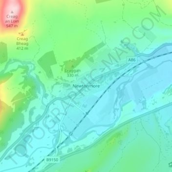
Name: Newtonmore topographic map, elevation, terrain.
Location: Newtonmore, Highland, Scotland, PH20 1DN, United Kingdom (57.04553 -4.13936 57.08553 -4.09936)
Average elevation: 283 m
Minimum elevation: 223 m
Maximum elevation: 536 m
Thank you for supporting this site ❤️
Make a donation
Make a donation
Other topographic maps
Click on a map to view its topography, its elevation and its terrain.