
Göd topographic map
Interactive map
Click on the map to display elevation.
About this map
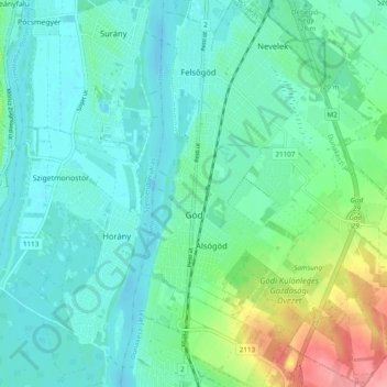
Name: Göd topographic map, elevation, terrain.
Location: Göd, Dunakeszi járás, Pest, Central Hungary, Hungary (47.65448 19.12070 47.71940 19.19184)
Average elevation: 118 m
Minimum elevation: 98 m
Maximum elevation: 188 m