
Patumāhoe topographic map
Interactive map
Click on the map to display elevation.
About this map
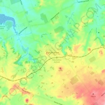
Name: Patumāhoe topographic map, elevation, terrain.
Location: Patumāhoe, Franklin, Auckland, 2678, New Zealand (-37.22774 174.78823 -37.14774 174.86823)
Average elevation: 54 m
Minimum elevation: 0 m
Maximum elevation: 131 m
Auckland trails, hiking, mountain biking, running and outdoor activities
Other topographic maps
Click on a map to view its topography, its elevation and its terrain.