
Cantón Pérez Zeledón topographic map
Interactive map
Click on the map to display elevation.
About this map
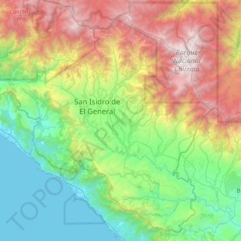
Name: Cantón Pérez Zeledón topographic map, elevation, terrain.
Location: Cantón Pérez Zeledón, Provincia San José, Costa Rica (9.07996 -84.00534 9.59845 -83.42514)
Average elevation: 1,213 m
Minimum elevation: -1 m
Maximum elevation: 3,780 m
Its main attraction is its ecological diversity. There are such sites as the Chirripó National Park (one of the highest peak in Central America and the Caribbean, with an elevation of 3,820 meters above sea level) and great scenic beauty, flora and fauna all throughout.
Other topographic maps
Click on a map to view its topography, its elevation and its terrain.
Catedral
Costa Rica > Provincia San José > Catedral
Catedral, Cantón San José, Provincia San José, 10104, Costa Rica
Average elevation: 1,155 m