
Thank you for supporting this site ❤️
Make a donation
Make a donation
Georgian Bluffs topographic map
Click on the map to display elevation.
Thank you for supporting this site ❤️
Make a donation
Make a donation
About this map
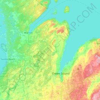
Name: Georgian Bluffs topographic map, elevation, terrain.
Location: Georgian Bluffs, Grey County, Ontario, Canada (44.45280 -81.14040 44.88481 -80.81468)
Average elevation: 228 m
Minimum elevation: 171 m
Maximum elevation: 414 m
Thank you for supporting this site ❤️
Make a donation
Make a donation