
Lütjenburg topographic map
Interactive map
Click on the map to display elevation.
About this map
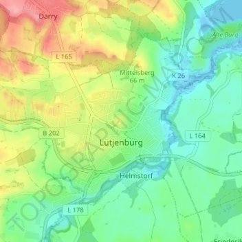
Name: Lütjenburg topographic map, elevation, terrain.
Location: Lütjenburg, Plön, Schleswig-Holstein, Germany (54.28286 10.55179 54.30908 10.61623)
Average elevation: 37 m
Minimum elevation: -5 m
Maximum elevation: 103 m