
Thank you for supporting this site ❤️
Make a donation
Make a donation
Bathgate topographic map
Click on the map to display elevation.
Thank you for supporting this site ❤️
Make a donation
Make a donation
Bathgate
In the 1846 book A Topographical Dictionary of Scotland, Samuel Lewis writes.
Thank you for supporting this site ❤️
Make a donation
Make a donation
About this map
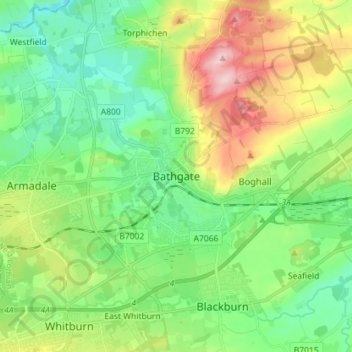
Name: Bathgate topographic map, elevation, terrain.
Location: Bathgate, West Lothian, Scotland, EH48 1PA, United Kingdom (55.86092 -3.68148 55.94092 -3.60148)
Average elevation: 167 m
Minimum elevation: 97 m
Maximum elevation: 311 m
Thank you for supporting this site ❤️
Make a donation
Make a donation