
Thank you for supporting this site ❤️
Make a donation
Make a donation
Haines City topographic map
Click on the map to display elevation.
Thank you for supporting this site ❤️
Make a donation
Make a donation
About this map
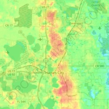
Name: Haines City topographic map, elevation, terrain.
Location: Haines City, Polk County, Florida, 33844, United States (28.06647 -81.66950 28.18674 -81.55065)
Average elevation: 40 m
Minimum elevation: 19 m
Maximum elevation: 69 m
Thank you for supporting this site ❤️
Make a donation
Make a donation
Other topographic maps
Click on a map to view its topography, its elevation and its terrain.