
Thank you for supporting this site ❤️
Make a donation
Make a donation
Normandy Park topographic map
Click on the map to display elevation.
Thank you for supporting this site ❤️
Make a donation
Make a donation
About this map
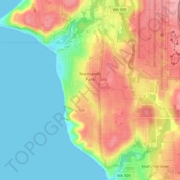
Name: Normandy Park topographic map, elevation, terrain.
Location: Normandy Park, King County, Washington, United States (47.40424 -122.36223 47.45784 -122.32640)
Average elevation: 57 m
Minimum elevation: -1 m
Maximum elevation: 136 m
Thank you for supporting this site ❤️
Make a donation
Make a donation