
Thank you for supporting this site ❤️
Make a donation
Make a donation
Glenrothes topographic map
Click on the map to display elevation.
Thank you for supporting this site ❤️
Make a donation
Make a donation
About this map
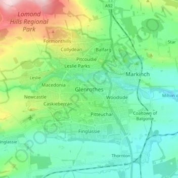
Name: Glenrothes topographic map, elevation, terrain.
Location: Glenrothes, Fife, Scotland, KY7 5LW, United Kingdom (56.15619 -3.21163 56.23619 -3.13163)
Average elevation: 106 m
Minimum elevation: 32 m
Maximum elevation: 324 m
Thank you for supporting this site ❤️
Make a donation
Make a donation
Other topographic maps
Click on a map to view its topography, its elevation and its terrain.