
Thank you for supporting this site ❤️
Make a donation
Make a donation
Resolution Island topographic map
Click on the map to display elevation.
Thank you for supporting this site ❤️
Make a donation
Make a donation
About this map
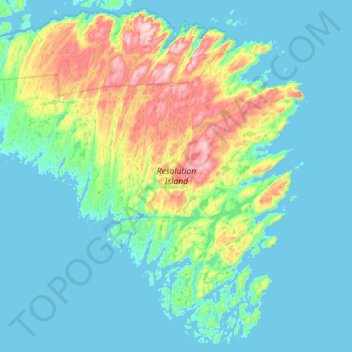
Name: Resolution Island topographic map, elevation, terrain.
Location: Resolution Island, Qikiqtaaluk Region, Nunavut, Canada (61.30866 -65.47219 61.69518 -64.62201)
Average elevation: 85 m
Minimum elevation: -1 m
Maximum elevation: 484 m
Thank you for supporting this site ❤️
Make a donation
Make a donation