
Mértola topographic map
Interactive map
Click on the map to display elevation.
About this map
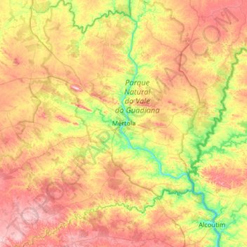
Name: Mértola topographic map, elevation, terrain.
Location: Mértola, Beja, Baixo Alentejo, Alentejo Region, Portugal (37.43200 -7.93417 37.84941 -7.42635)
Average elevation: 162 m
Minimum elevation: 0 m
Maximum elevation: 354 m