
Thank you for supporting this site ❤️
Make a donation
Make a donation
Heriot topographic map
Click on the map to display elevation.
Thank you for supporting this site ❤️
Make a donation
Make a donation
About this map
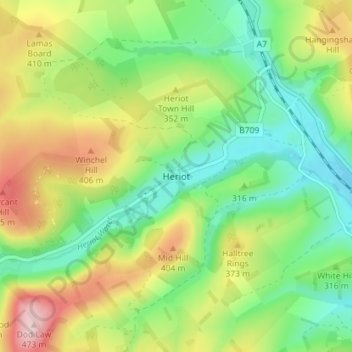
Name: Heriot topographic map, elevation, terrain.
Location: Heriot, Scottish Borders, Scotland, EH38 5YE, United Kingdom (55.74479 -2.98874 55.78479 -2.94874)
Average elevation: 323 m
Minimum elevation: 231 m
Maximum elevation: 471 m
Thank you for supporting this site ❤️
Make a donation
Make a donation
Other topographic maps
Click on a map to view its topography, its elevation and its terrain.