
Eggedal topographic map
Interactive map
Click on the map to display elevation.
About this map
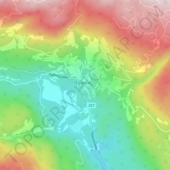
Name: Eggedal topographic map, elevation, terrain.
Location: Eggedal, Sigdal, Buskerud, 3359, Norway (60.22576 9.33751 60.26576 9.37751)
Average elevation: 479 m
Minimum elevation: 232 m
Maximum elevation: 837 m