
Brooklyn topographic map
Interactive map
Click on the map to display elevation.
About this map
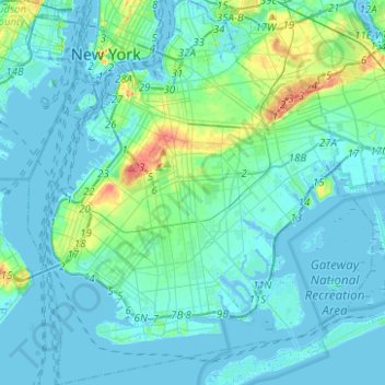
Name: Brooklyn topographic map, elevation, terrain.
Location: Brooklyn, Kings County, New York, United States (40.55034 -74.05669 40.73943 -73.83295)
Average elevation: 9 m
Minimum elevation: -10 m
Maximum elevation: 62 m
Other topographic maps
Click on a map to view its topography, its elevation and its terrain.