
Champaign County topographic map
Interactive map
Click on the map to display elevation.
Champaign County
The topography of Champaign County was formed by the Wisconsin Glacier about 20,000 years before the present. Lobes of ice from what is now Lake Michigan crossed the county, creating a deep pile of glacial soil, up to 300 feet thick, topped by numerous moraines forming small, flat watersheds with no outlets.
About this map
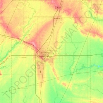
Name: Champaign County topographic map, elevation, terrain.
Location: Champaign County, Illinois, United States of America (39.87910 -88.46357 40.40068 -87.92882)
Average elevation: 217 m
Minimum elevation: 187 m
Maximum elevation: 260 m
Other topographic maps
Click on a map to view its topography, its elevation and its terrain.