
Purerua topographic map
Interactive map
Click on the map to display elevation.
About this map
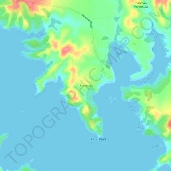
Name: Purerua topographic map, elevation, terrain.
Location: Purerua, Far North District, Northland, New Zealand (-35.17513 174.01513 -35.13513 174.05513)
Average elevation: 15 m
Minimum elevation: 0 m
Maximum elevation: 86 m
Other topographic maps
Click on a map to view its topography, its elevation and its terrain.
Tikorangi Island
Tikorangi Island, Purerua, Far North District, Northland, New Zealand
Average elevation: 5 m