
Lochgair topographic map
Interactive map
Click on the map to display elevation.
About this map
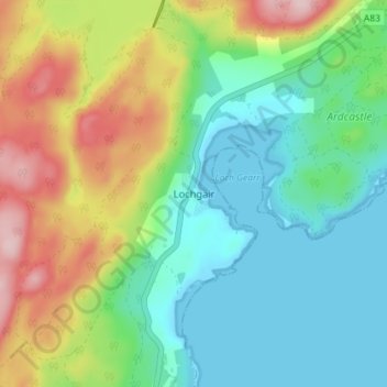
Name: Lochgair topographic map, elevation, terrain.
Location: Lochgair, Argyll and Bute, Scotland, PA31 8UJ, United Kingdom (56.04224 -5.35753 56.08224 -5.31753)
Average elevation: 73 m
Minimum elevation: 0 m
Maximum elevation: 221 m