
L'Aquila topographic map
Interactive map
Click on the map to display elevation.
About this map
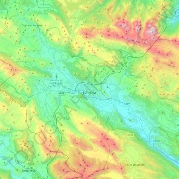
Name: L'Aquila topographic map, elevation, terrain.
Location: L'Aquila, AQ, Abruzzo, Italy (42.17778 13.17723 42.53286 13.65410)
Average elevation: 1,191 m
Minimum elevation: 508 m
Maximum elevation: 2,865 m
Other topographic maps
Click on a map to view its topography, its elevation and its terrain.