
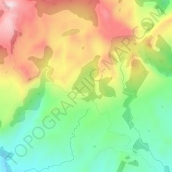
Lake Opouahi topographic map
Interactive map
Click on the map to display elevation.
About this map
Name: Lake Opouahi topographic map, elevation, terrain.
Average elevation: 477 m
Minimum elevation: 289 m
Maximum elevation: 707 m
Other topographic maps
Click on a map to view its topography, its elevation and its terrain.
Te Mata Peak
Te Mata Peak, Hastings, Hastings District, Hawke's Bay, 4130, New Zealand
Average elevation: 144 m
Te Mata Peak
Te Mata Peak, Hastings, Hastings District, Hawke's Bay, 4294, New Zealand
Average elevation: 145 m
Tutaekuri River
Tutaekuri River, Hastings, Hastings District, Hawke's Bay, 4142, New Zealand
Average elevation: 252 m
Raupare Stream
Raupare Stream, Hastings, Hastings District, Hawke's Bay, 4122, New Zealand
Average elevation: 8 m
Clive River
Clive River, Hastings, Hastings District, Hawke's Bay, 4102, New Zealand
Average elevation: 5 m