
Lake Wilson topographic map
Interactive map
Click on the map to display elevation.
About this map
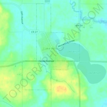
Name: Lake Wilson topographic map, elevation, terrain.
Location: Lake Wilson, Murray County, Minnesota, USA (43.98993 -95.96395 44.00089 -95.94374)
Average elevation: 507 m
Minimum elevation: 497 m
Maximum elevation: 522 m