
Green County topographic map
Interactive map
Click on the map to display elevation.
About this map
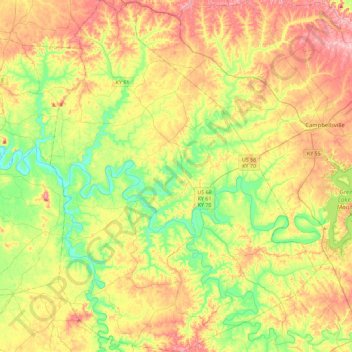
Name: Green County topographic map, elevation, terrain.
Location: Green County, Kentucky, United States of America (37.10935 -85.69725 37.47105 -85.35323)
Average elevation: 230 m
Minimum elevation: 148 m
Maximum elevation: 334 m
Other topographic maps
Click on a map to view its topography, its elevation and its terrain.
Lexington
United States of America > Kentucky > Lexington
Lexington, Fayette County, Kentucky, 40508, United States of America
Average elevation: 285 m