
Longyearbyen topographic map
Interactive map
Click on the map to display elevation.
About this map
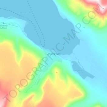
Name: Longyearbyen topographic map, elevation, terrain.
Location: Longyearbyen, Svalbard, 9171, Norway (78.06316 15.48637 78.38316 15.80637)
Average elevation: 249 m
Minimum elevation: -1 m
Maximum elevation: 1,060 m