
Otisville topographic map
Interactive map
Click on the map to display elevation.
About this map
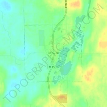
Name: Otisville topographic map, elevation, terrain.
Location: Otisville, Genesee County, Michigan, 48463, USA (43.15873 -83.53476 43.17332 -83.51465)
Average elevation: 248 m
Minimum elevation: 235 m
Maximum elevation: 265 m