
Lake Laberge topographic map
Interactive map
Click on the map to display elevation.
About this map
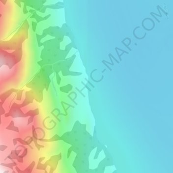
Name: Lake Laberge topographic map, elevation, terrain.
Location: Lake Laberge, Macpherson-Grizzly Valley, Yukon, Canada (61.21927 -135.25082 61.22087 -135.25000)
Average elevation: 710 m
Minimum elevation: 581 m
Maximum elevation: 1,119 m
Other topographic maps
Click on a map to view its topography, its elevation and its terrain.