
Høvringen topographic map
Interactive map
Click on the map to display elevation.
About this map
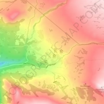
Name: Høvringen topographic map, elevation, terrain.
Location: Høvringen, Sel, Oppland, 2673, Norway (61.87335 9.45742 61.91335 9.49742)
Average elevation: 1,023 m
Minimum elevation: 741 m
Maximum elevation: 1,195 m