
Ormiston topographic map
Interactive map
Click on the map to display elevation.
About this map
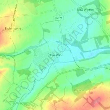
Name: Ormiston topographic map, elevation, terrain.
Location: Ormiston, East Lothian, Scotland, EH35 5HN, United Kingdom (55.89285 -2.95984 55.93285 -2.91984)
Average elevation: 102 m
Minimum elevation: 75 m
Maximum elevation: 159 m
Ormiston is a village in East Lothian, Scotland, near Tranent, Humbie, Pencaitland and Cranston, located on the north bank of the River Tyne at an elevation of about 276 feet (84 m).