Sault Ste. Marie topographic map
Interactive map
Click on the map to display elevation.
About this map
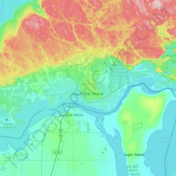
Name: Sault Ste. Marie topographic map, elevation, terrain.
Average elevation: 249 m
Minimum elevation: 173 m
Maximum elevation: 452 m

Click on the map to display elevation.
Name: Sault Ste. Marie topographic map, elevation, terrain.
Average elevation: 249 m
Minimum elevation: 173 m
Maximum elevation: 452 m