
Tagoloan River topographic map
Interactive map
Click on the map to display elevation.
About this map
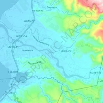
Name: Tagoloan River topographic map, elevation, terrain.
Average elevation: 94 m
Minimum elevation: -5 m
Maximum elevation: 647 m
Other topographic maps
Click on a map to view its topography, its elevation and its terrain.
Tagoloan River
Philippines > Misamis Oriental > Tagoloan
Tagoloan River, Tagoloan, Misamis Oriental, Northern Mindanao, 9001, Philippines
Average elevation: 7 m