
Kepulauan Aru topographic map
Interactive map
Click on the map to display elevation.
About this map
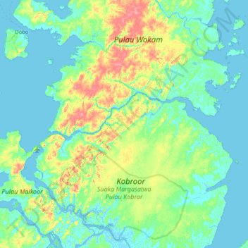
Name: Kepulauan Aru topographic map, elevation, terrain.
Location: Kepulauan Aru, Maluku, Indonesia (-6.32000 134.18000 -5.68000 134.82000)
Average elevation: 16 m
Minimum elevation: -4 m
Maximum elevation: 81 m
Other topographic maps
Click on a map to view its topography, its elevation and its terrain.