
Woodson County topographic map
Interactive map
Click on the map to display elevation.
About this map
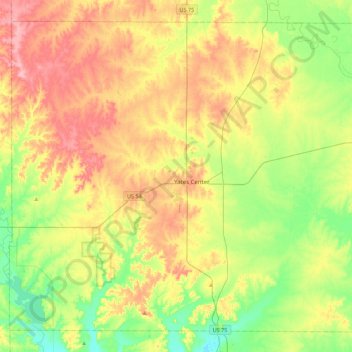
Name: Woodson County topographic map, elevation, terrain.
Location: Woodson County, Kansas, USA (37.73322 -95.96045 38.04020 -95.51897)
Average elevation: 317 m
Minimum elevation: 265 m
Maximum elevation: 383 m
Other topographic maps
Click on a map to view its topography, its elevation and its terrain.
Lake Jeanette
USA > Kansas > Leavenworth
Lake Jeanette, Lakeside Drive, Leavenworth, Leavenworth County, Kansas, 66043, USA
Average elevation: 253 m
Independence
USA > Kansas > Independence
Independence, Montgomery County, Kansas, 67301, USA
Average elevation: 245 m