
Whangamomona topographic map
Interactive map
Click on the map to display elevation.
About this map
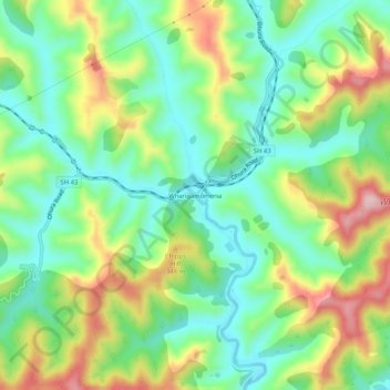
Name: Whangamomona topographic map, elevation, terrain.
Location: Whangamomona, Manawatu-Wanganui, New Zealand (-39.16466 174.71563 -39.12466 174.75563)
Average elevation: 235 m
Minimum elevation: 145 m
Maximum elevation: 389 m