
Ellis River topographic map
Interactive map
Click on the map to display elevation.
About this map
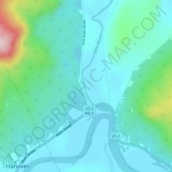
Name: Ellis River topographic map, elevation, terrain.
Location: Ellis River, Oxford County, Maine, USA (44.50468 -70.68005 44.51446 -70.67360)
Average elevation: 238 m
Minimum elevation: 180 m
Maximum elevation: 503 m
Other topographic maps
Click on a map to view its topography, its elevation and its terrain.
Bryant Pond
USA > Maine > Bryant Pond
Bryant Pond, Oxford County, Maine, 04255, USA
Average elevation: 270 m
Cunningham Mountains
Cunningham Mountains, Penobscot County, Maine, USA
Average elevation: 262 m
Pleasant River
Pleasant River, Washington County, Maine, 04632, USA
Average elevation: 29 m