
Hvannadalshnúkur topographic map
Interactive map
Click on the map to display elevation.
About this map
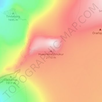
Name: Hvannadalshnúkur topographic map, elevation, terrain.
Location: Hvannadalshnúkur, Iceland (64.01410 -16.67701 64.01420 -16.67691)
Average elevation: 1,794 m
Minimum elevation: 1,435 m
Maximum elevation: 2,049 m
Other topographic maps
Click on a map to view its topography, its elevation and its terrain.
Seydisfjordur
Seydisfjordur, Múlaþing, Eastern Region, 710, Iceland
Average elevation: 443 m
Grindavík
Grindavík, Grindavíkurbær, Southern Peninsula, 240, Iceland
Average elevation: 27 m
Herðubreið
Herðubreið, Skútustaðahreppur, Northeastern Region, Iceland
Average elevation: 1,182 m
Tindfjallajökull
Tindfjallajökull, Hungurfitaskáli, Rangárþing ytra, Southern Region, Iceland
Average elevation: 1,059 m